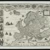


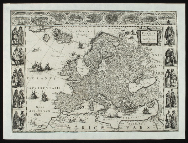
Map of Europe 1617
Description (English)
Jan Blaeu was an Amsterdam cartographer who garnered great fame during his lifetime with his detailed maps. The quantity of maps he pproduced was also considerable. His most important work, the Atlas Maior, contains no fewer than 600 maps! Interestingly, this map not only features topographical features, but its margins are also filled with a number of prints of cities and typical local dress. It can also clear that the proportion of length to height is are not as we know them. This is because it was still not possible to determine longitude precisely over large distances. That problem would be solved a century later.
On this page we provide metadata using the Dublin Core metadata format. The metadata is derived in most cases from metadata found in the source collection; in some cases we have added additional information where it was not available.